Crossing Lines

Project Description

Both a temporary exhibition and site activation, CROSSING LINES explores how material and immaterial lines impact the people of Chicago, historically and presently. Hosted at the historic site of Sears, Roebuck and Co. Complex, visitors will be able to see Chicago’s West Side from the top floor of the original merchandise tower and walk a self-guided tour of the elevated rail that once served the complex. Visitors will have an opportunity to playfully engage with the influence of Lines created by abstracted planning, mapping, legislative, and bureaucratic protocols. This rail was the central area of focus for the related project, the Altenheim Line Framework Plan.

We are grateful to have had the opportunity to partner with the 2023 Chicago Architecture Biennial: This is a Rehearsal.

Project documentation by AVEH Studio.

Sources: Sears Roebuck and Company Campus, Altenheim Line Framework Plan, Institute for Linear Research, Live Location of the International Space Station, Satellite Map, Mapping Inequality, Impact of Native American trails on Chicago, Construction of I-290

Project Details

Date
2023
Location
Chicago, IL

Partners

Chicago Architecture Biennial: This is a Rehearsal, Foundation for Homan Square, Institute for Linear Research (ILR)
Closeup of the map highlighting the intersections of various lines around Nichols Tower

Project Gallery

The site activation could be seen from the 14th floor of Nichols Tower
Different color fabrics represented various different lines that cross the Altenheim Line itself
The installation extended westward through a mirror representation
The CSX rail is highlighted by the vibrant red fabric draped across its tracks
The elevated rail crosses through various conditions: occupied buildings, vacant land, parking lots, and residential homes
Visitors walked along, over, and across the line
Visitors read about the LINE to Venice
Nichols Tower 14th floor exhibition of various crossing lines, the LINE to Venice, and a view out to the site activation
The site activation started at the entry ramp to the elevated rail at Homan Avenue
  1. 1 Altenheim Line Framework Plan

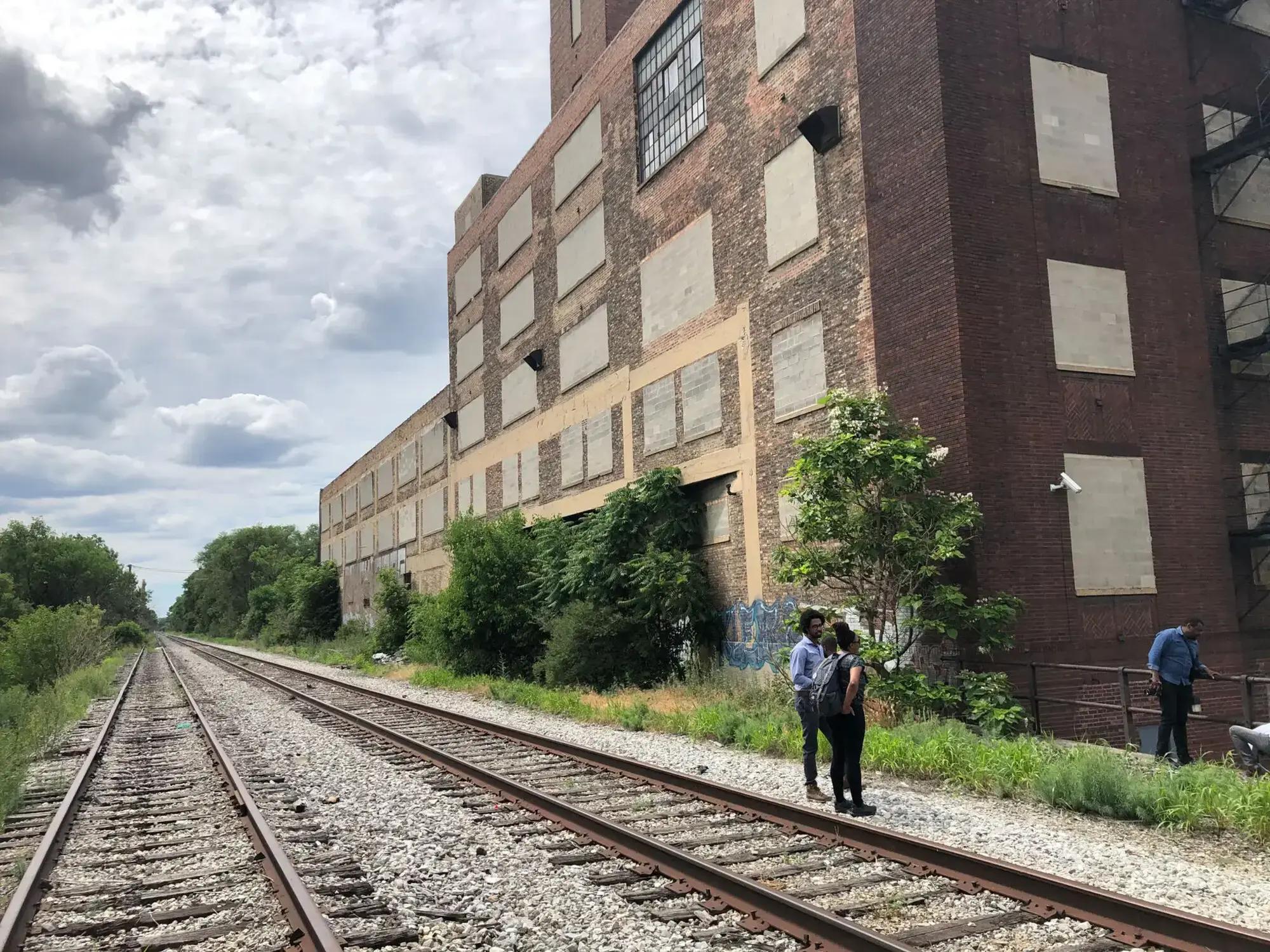
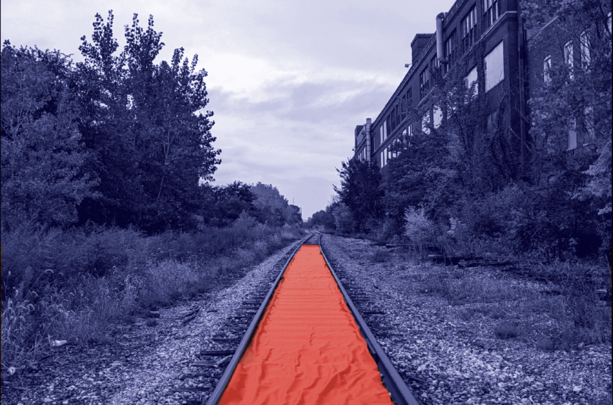
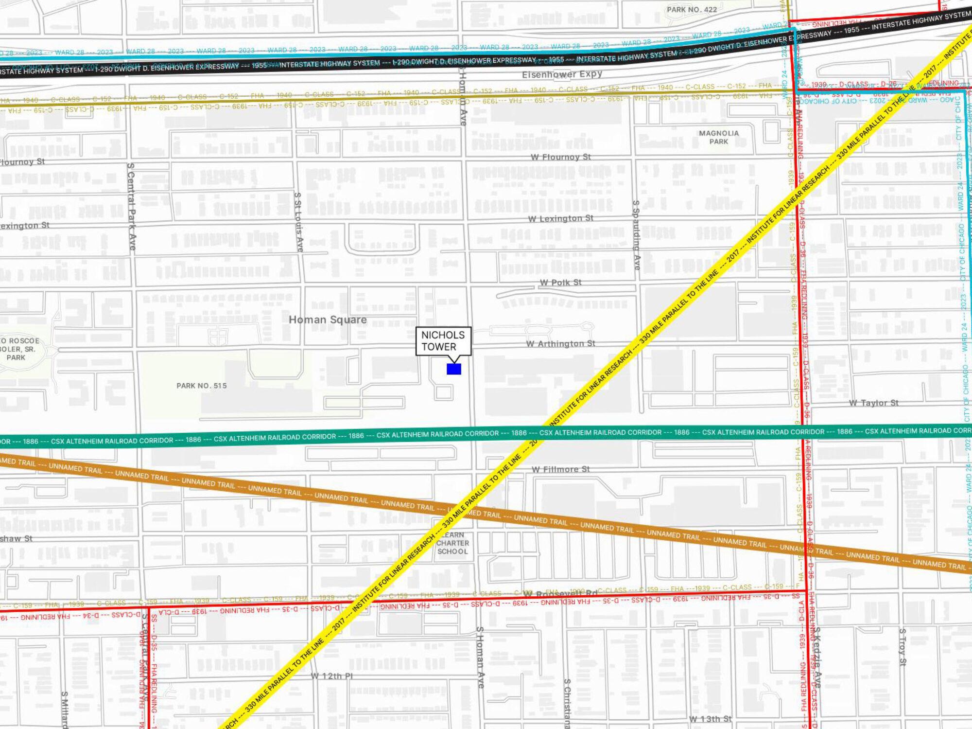
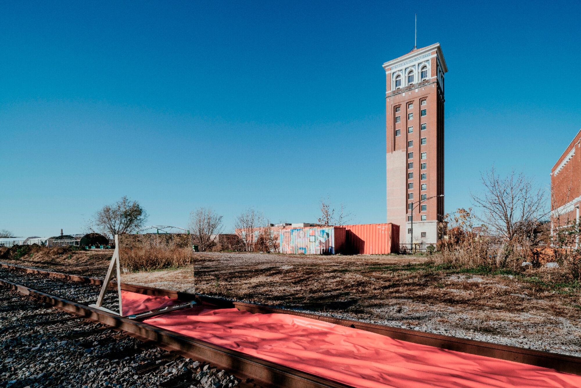
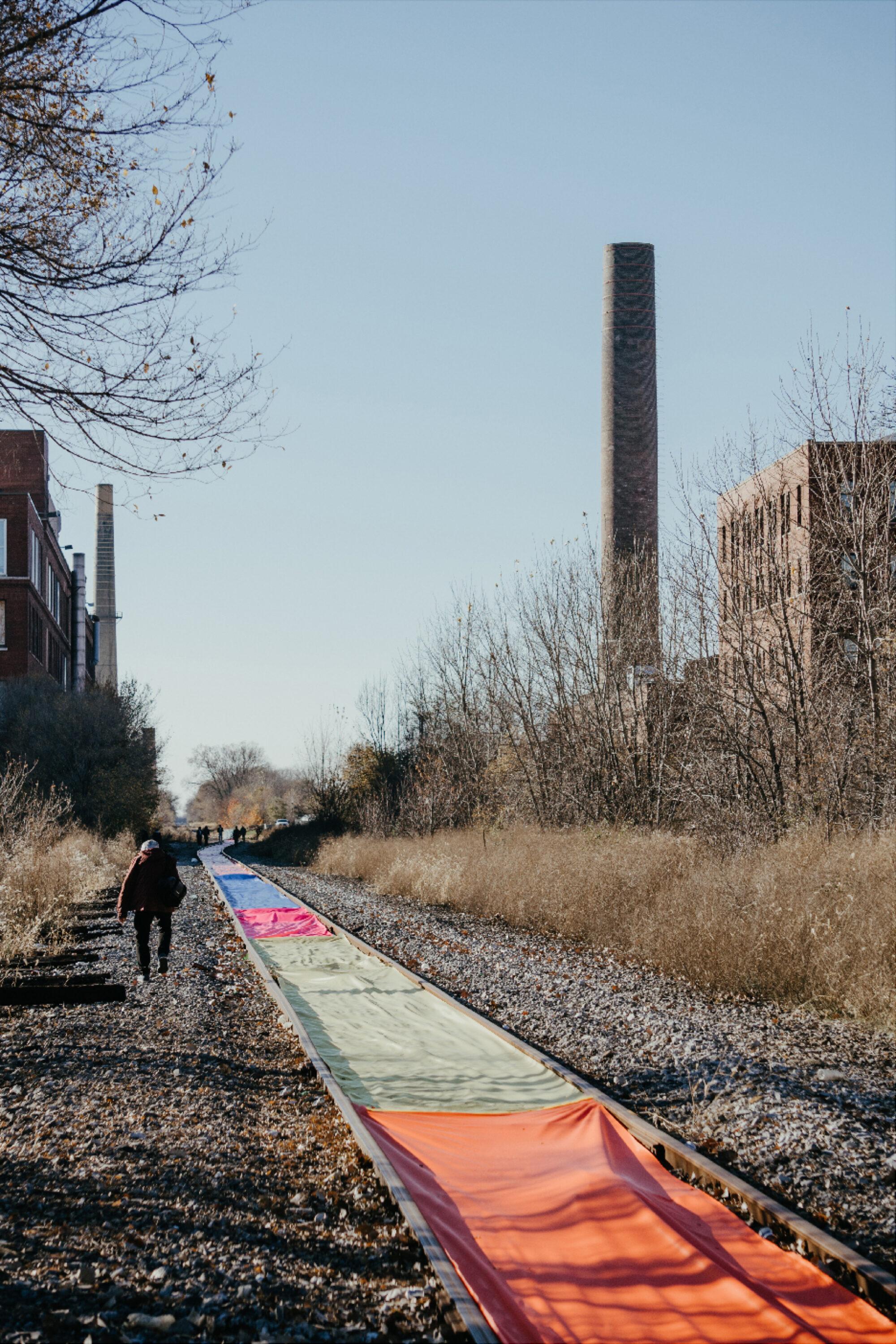
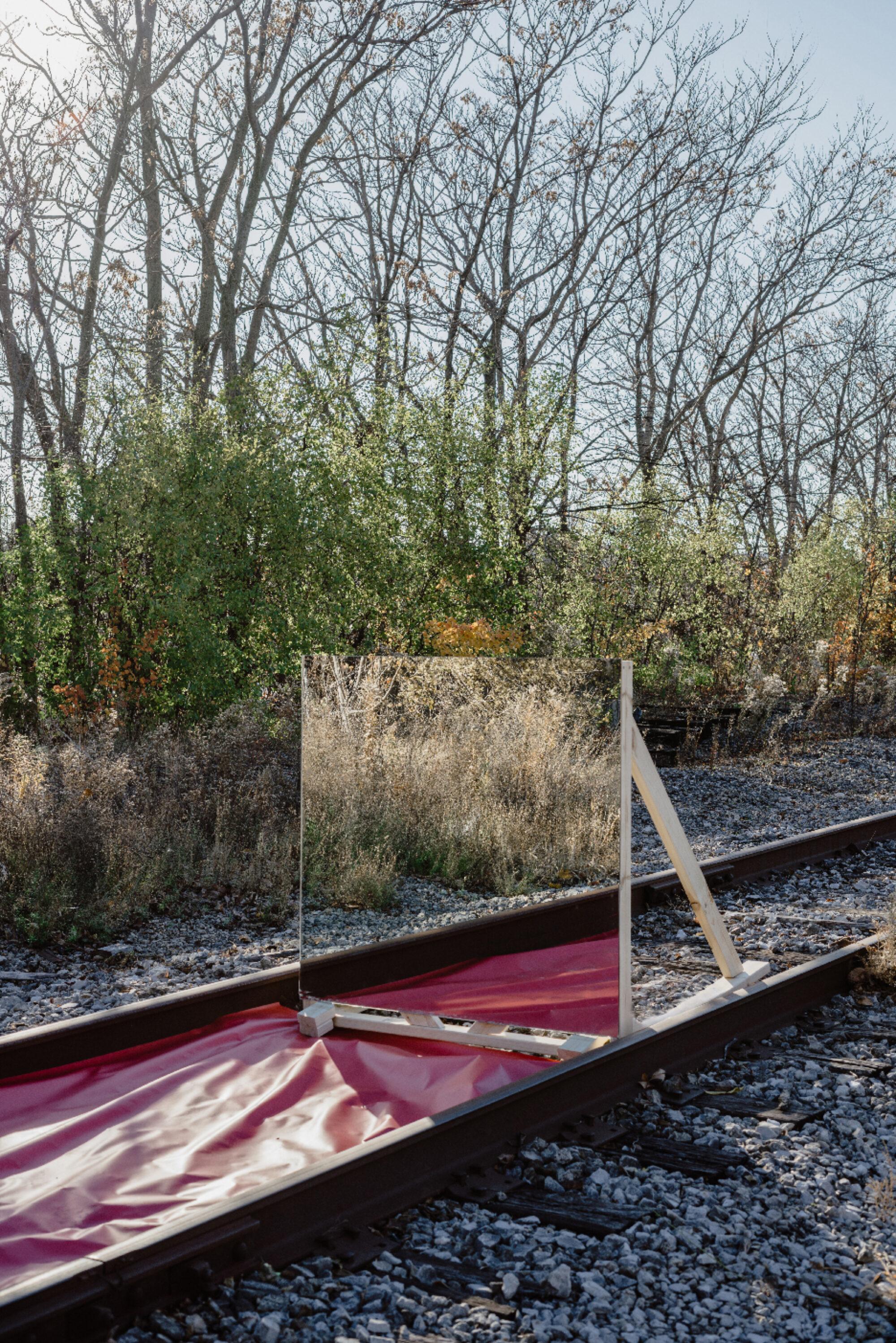
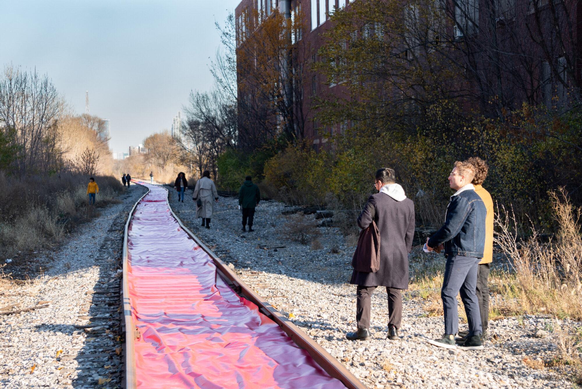
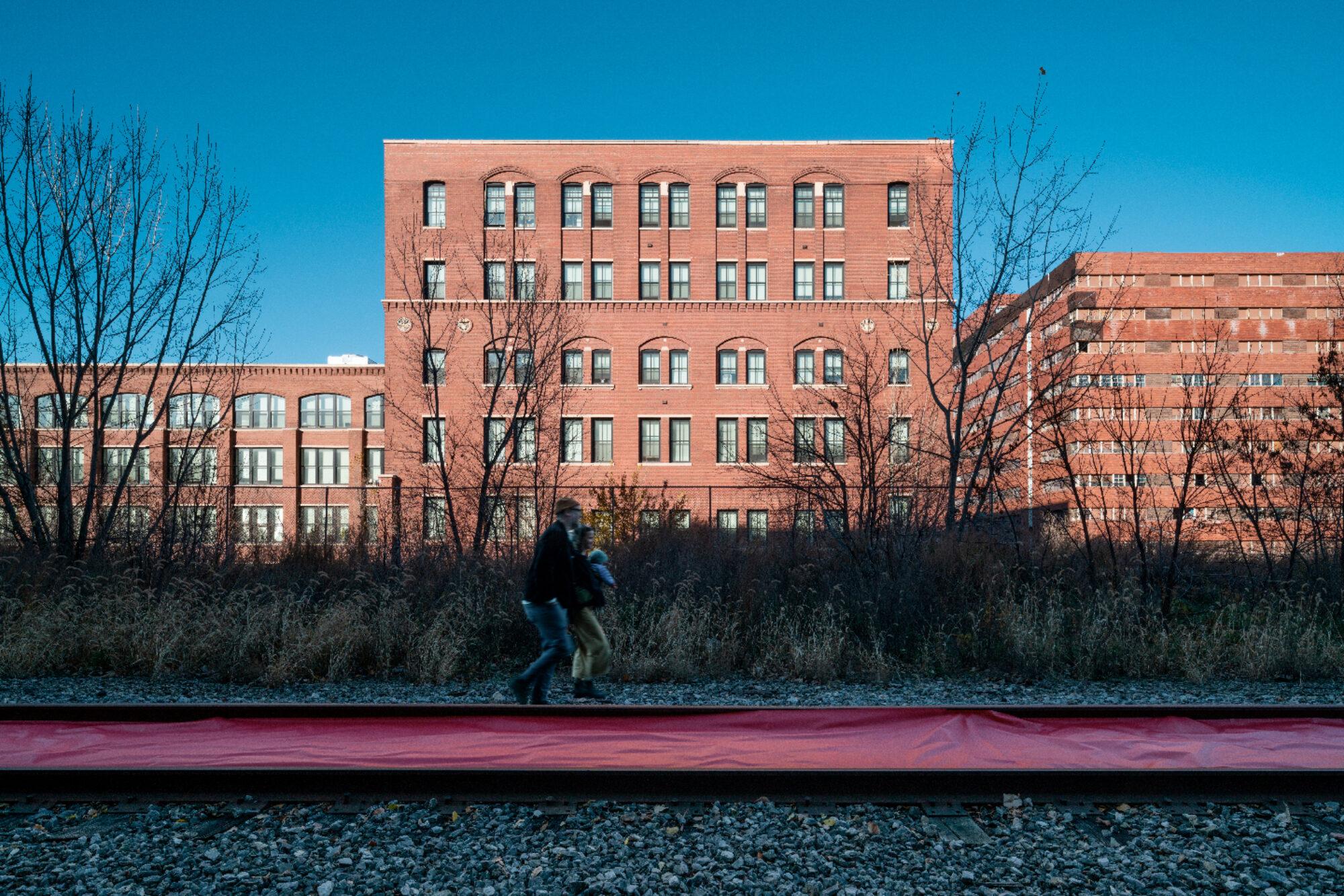
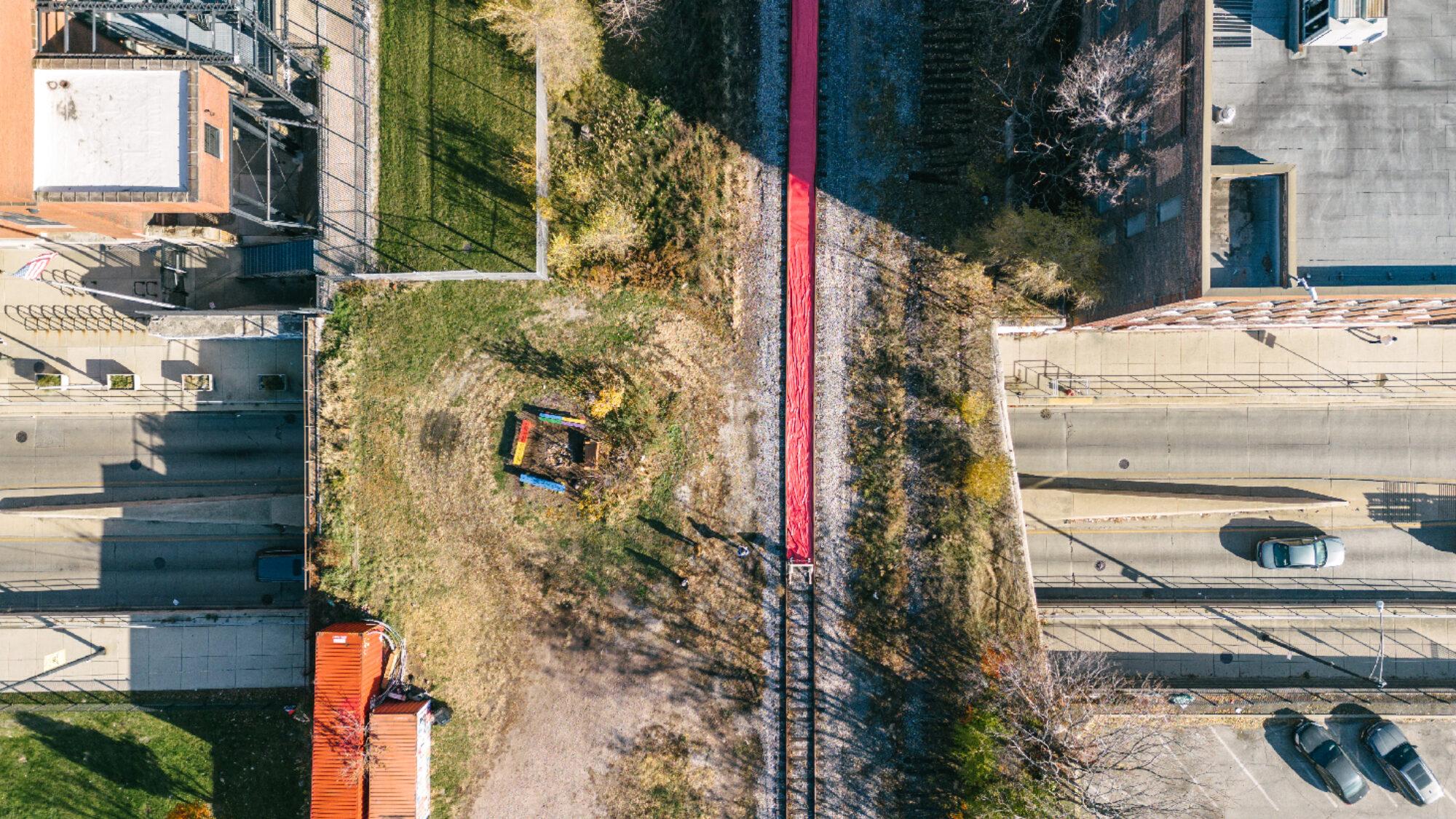
    The Altenheim Line Framework Plan centers on the elevated freight rail running through the North Lawndale and Garfield Park community areas, creating the framework for a future “rails and trails” park. The Framework Plan guides industrial & commercial development and a residential housing strategy to bring new vibrancy and stability to the neighborhood and avoid the displacement pressure that has occurred around previous amenities like the 606. The rail is owned by CSX Transportation, constructed in 1886. Access to the route was key for Sears, Roebuck, and Company, whose campus was constructed right along the rail’s right-of-way. The “Altenheim Line” is a placeholder name for the future rails and trails project, borrowing the name of this segment of rail that runs through Homan Square. See more about the history of the historic campus here: https://www.madeinchicagomuseum.com/single-post/sears-roebuck/

  2. 2 International Space Station

    A flying landmark itself - you can catch a sighting of it TONIGHT at 6:07 PM. The ISS is a science lab that does tests and studies various aspects of our planet and outer space. They use data from ECOsystem Spaceborne Thermal Radiometer Experiment on Space Station (ECOSTRESS), which measures subtle changes in temperature in plants and provides insight into land management, urban heat island detection and mitigation, drought, aquatic ecosystem and habitat assessment, thermal pollution from power plants, shellfisheries and coastal vegetation stress and risk, wildfires, public health, and geothermal and geology hazards. In addition to the ISS, there are 7,702 satellites and counting flying above us on various paths at all times. Satellites track and monitor our movements and this data is used to guide how people move through our built environment today. See a simulation of these satellites here: https://satellitemap.space/?constellation=starlink

  3. 3 THE LINE

    Created by the Institute for Linear Research (ILR) in 2017, THE LINE connects Liechtenstein to Venice, Italy and then continues around the globe. Anyone can walk THE LINE and document their experience by sending any findings to the ILR. Linear Research is based on imposing non-effective, imaginary lines on contemporary landscapes. Not to be confused with its conceptual opposite: effective lines, such as territorial borders. Methods of Linear Research include, but are not limited to Linear Walking and Linear Mapping. You can preview the ILR’s upcoming publication about walks that took place in the Midwest (Nebraska, Iowa, Minnesota, and Wisconsin) at their table in Nichol’s Tower.

  4. 4 Redlining

    Redlining was a practice of using data and evaluations that assigned grades of residential neighborhoods to reflect that neighborhood’s “mortgage security” for real estate professionals such as lenders, developers, and real estate appraisers. Actively used between 1935-1940, the practice was created by the federal agency, the Home Owners’ Loan Corporation. (Robert K. Nelson, LaDale Winling, Richard Marciano, Nathan Connolly, et al., “Mapping Inequality,” American Panorama, ed. Robert K. Nelson and Edward L. Ayers, accessed November 14, 2023, https://dsl.richmond.edu/panorama/redlining/)

  5. 5 Native American Trails

    The Scharf Map, created in 1901, maps the trails used by Native Americans and trade routes through the Village of Chicago and Cook, DuPage, and Will Counties, IL. These ancient trails were started on low ridges left behind by receding glaciers that converge at the mouth of the Chicago River. Although Chicago’s city planning overlays a grid amongst a natural landscape, a few key streets can be found following the paths walked by the people before us: Ogden Avenue following the Portage Trail, Barry Point Trail later became 5th avenue, and Lake Street that once was the Lake Street Trail. These connect the Chicago River with the DesPlaines River and beyond.

  6. 6 I-290

    The expressway started construction in 1955 and continued into the 80s. It was named in honor of President Dwight D. Eisenhower, who conceived the original Interstate Highway System idea based on the German Autobahn. Its construction within Chicago resulted in the displacement of 13,000 individuals and the destruction of 400 businesses. The expressway replaced a rapid transit line from 1895 called the Metropolitan West Side Elevated Railroad. The Garfield Park branch was demolished for I-290 and replaced with the CTA Blue Line in the median. Despite being Chicago's first central expressway and costing $183 million and displacing thousands of residents, the project did not effectively address traffic congestion. Source: https://interactive.wbez.org/curiouscity/eisenhower/